Posts

Winter Storm Potential Discussion
Image
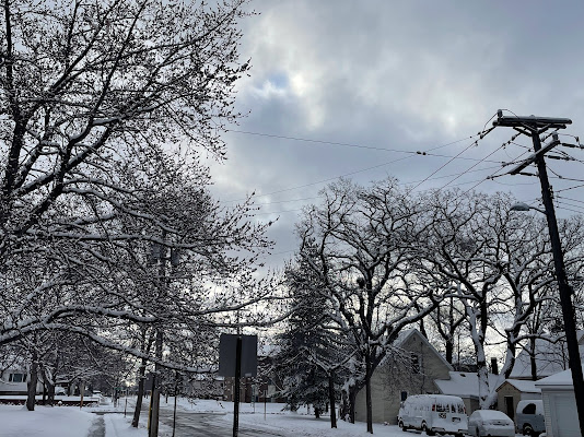
A Powerful Winter Storm On the Horizon(?) 03/22/2024 by Aidan Cera Good evening central Minnesota, future undergraduate meteorologist Aidan Cera here with your latest weather discussion regarding the potential for a potent winter storm to impact our area over the next few days. A Look Back At Last Night's Snowfall An Alberta Clipper type winter storm made it's way across the Upper Midwest yesterday and brought a fairly decent amount of snow to central Minnesota. The heaviest totals noted were along a very narrow corridor starting in southeastern Pope County extending almost due east just south of St. Cloud, MN and into northwestern WI. Most locations received at least 2 inches of snow, with the highest amounts being 8" where the narrow, heavy band tracked.  While much of the snow did melt today, overall it was MUCH needed, as most of Minnesota is still in a moderate to severe drought carrying over from last summer and the lack of any significant precipitation since Decembe...

September 23rd Severe Weather Discussion

Image
 Central Minnesota Severe Weather Discussion For September 23rd, 2023 By Aidan Cera  Figure 1. Weather Prediction Center 00Z 23 September Outlook Issued 21Z Friday 22 September. Good evening central Minnesota. It has been quite sometime since I have made any posts here. My course work for my final year of undergraduate school has been quite demanding, on top of formulating a senior project, forecasting for US Bank Stadium and working 2 jobs. My goal was to upload posts whenever significant weather would be a possibility. Sticking to that promise to myself, tonight is one of those nights where a blog post is likely warranted. Figure 2. Storm Prediction Center Outlook for Saturday, 23 September, 2023.  The Storm Prediction Center has issued a slight risk for portions of the forecast area for tomorrow, Saturday September 23rd. The severe weather hazards are large hail, damaging winds, and perhaps a tornado or two.  Talking synoptics, an area of low pressure currently lo...

August 23rd Central Minnesota Weather Discussion

Image
 August 23rd Central Minnesota Weather Discussion  By Aidan Cera   Fig. 1. National Weather Service Twin Cities weather graphic for the next few days weather. Good evening central Minnesota! The last few days have been downright awful in terms of the heat and the humidity. Highs on Tuesday approached 100F with dew points approaching 80F. Today, the stratus deck held on much later in the day which prevented as much solar radiation from warning the surface. Thus, we were cooler in terms of temperatures but still extremely humid. Thankfully, this cooler weather has allowed the excessive heat warnings and heat advisories to expire as I send this post out.  Tonight, we are still looking at a downright warm and humid setup. Lows will likely only get down into the upper to mid 60F's with dew points in that range as well. This will likely lead more ptachy to widespread fog overnight through mid morning on Thursday. This fog will likely burn off mid morning and lead...

August 21st Central Minnesota Weather Discussion

Image
 August 21st Central Minnesota Weather Discussion by Aidan Cera Fig 1. National Weather Service Twin Cities Heat Wave Graphic for central Minnesota.  The main highlight of this discussion is going to be the heat in the short range, so this discussion is going to be rather quick, but I want to get the message regarding the heat out.  An Excessive Heat Warning is in effect for a good chunk of central Minnesota from August 22nd, 11:00 AM CDT until August 23, 10:00 PM CDT. Todd, Morrison and Mille Lacs counties are under a Heat Advisory for the same time as the Excessive Heat Warning.  Heat Indices are going to be very high tomorrow to nearly dangerous levels. The National Weather Service is forecasting heat index values from 97F to 112F or slightly higher across the forecast area. Heat Index values such as these are especially dangerous when spent in for long periods of time. Not only this, but any households or buildings without AC are going to be sweltering in te...

August 16th Central Minnesota Weather Discussion

Image
 August 16th Central Minnesota Weather Discussion By Aidan Cera Fig 1. Storm Prediction Center Convective Outlook for August 16th 2023 Issued at 1609Z. Good afternoon central Minnesota! Figured I would do a brief discussion on the possibility of severe weather across the region later this afternoon into the evening hours.  The Storm Prediction Center (SPC), has issued a slight risk for severe weather for the central and eastern portion of central Minnesota. All severe modes are possible, including damaging winds (15%), large hail (15%) and tornadoes (2%).  Fig 2. SPC surface analysis as of 1900Z (2:00 PM CDT). Red numbers indicate temperature and green values represent dew points in degrees Fahrenheit. Wind barbs show wind direction. As of around 2 PM CDT, a cold front was located in northwestern Minnesota and into southeastern North Dakota based on surface wind obs and pressure tendencies. This cold front is quickly advecting southeastward as the afternoon progresses and...

August 10th Central Minnesota Special Weather Discussion

Image
 August 10th Central Minnesota *Special* Weather Discussion By Aidan Cera Fig 1. Current Radar for the Upper Midwest as of 9:00 PM CST.  This is a special weather discussion for central Minnesota concerning a powerful line of thunderstorms that are tracking across western Minnesota and are heading toward central Minnesota. None of these storms are severe as of right now, however, I do want to bring attention to them as they could become severe over the next few hours as they track through the area.  Fig 2. NWS Twin Cities Severe Thunderstorm Watch valid until 2:00 AM CDT.  A severe thunderstorm watch has been issued for the following central Minnesota counties: Pope, Kandiyohi, Renville, Sibley, McLeod, Meeker and Stearns. Again, this watch will remain in effect until 2:00 AM CDT. The primary concerns are large hail up to ping pong ball size, winds up to 70 mph and frequent lightning.  These storms are currently making their way into Pope and Douglas counti...
Image
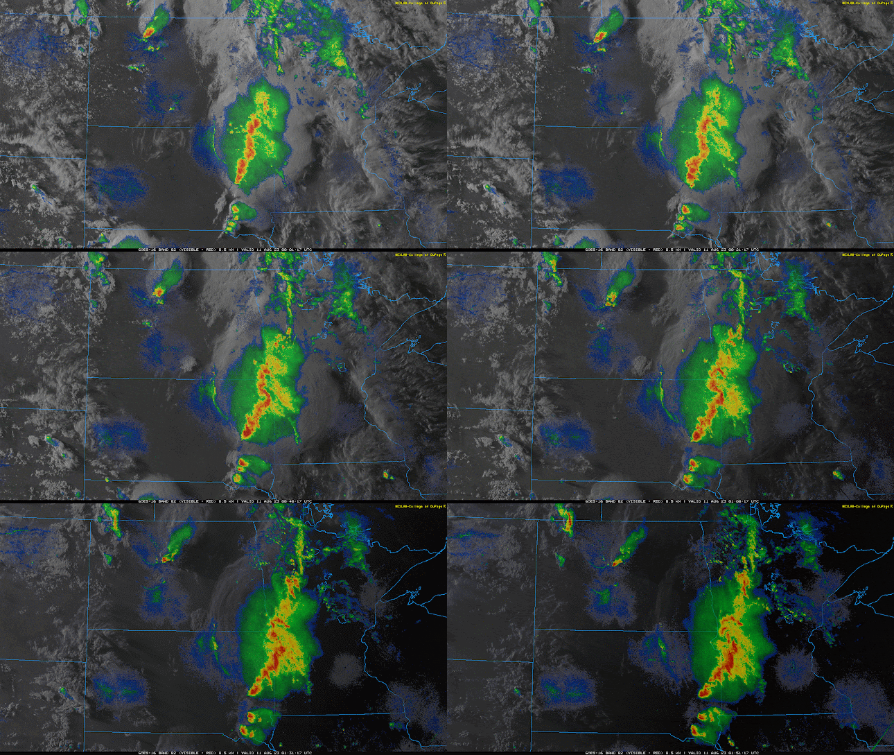
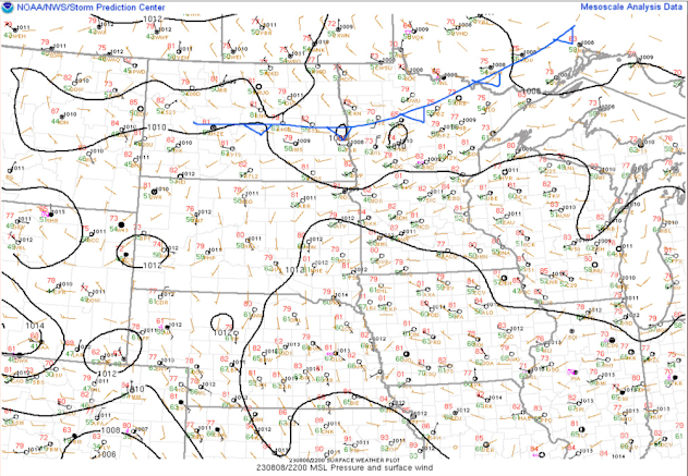
 August 8th Central Minnesota Weather Discussion By Aidan Cera  Fig 1. Storm Prediction Center Mesoanalysis valid 2200 UTC.  Good afternoon central Minnesota. Not much has changed with how the weather looks for the forecast period with regards to temperature but there have been some adjustments to our precipitation chances through late week.  Currently, there is a cold front extending down from Canada across northern Minnesota and through central North Dakota based on pressure, wind and temperature trends over the last few hours. Fig 2. Current visible satellite and radar imagery courtesy of College of DuPage Weather.  https://weather.cod.edu/satrad/?parms=subregional-N_Plains-02-24-1-100-1&checked=radar-map&colorbar=undefined We can also see the cold front on satellite and radar, with showers and thunderstorms developing out ahead of it across northern Minnesota into central North Dakota. These showers and thunderstorms will likely begin weakening ...