August 10th Central Minnesota Special Weather Discussion
August 10th Central Minnesota *Special* Weather Discussion
By Aidan Cera
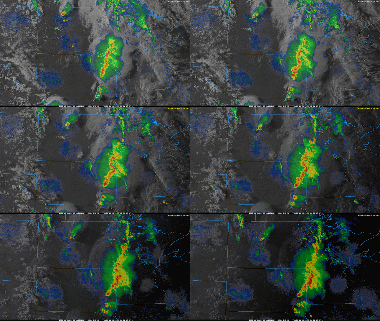
This is a special weather discussion for central Minnesota concerning a powerful line of thunderstorms that are tracking across western Minnesota and are heading toward central Minnesota. None of these storms are severe as of right now, however, I do want to bring attention to them as they could become severe over the next few hours as they track through the area.

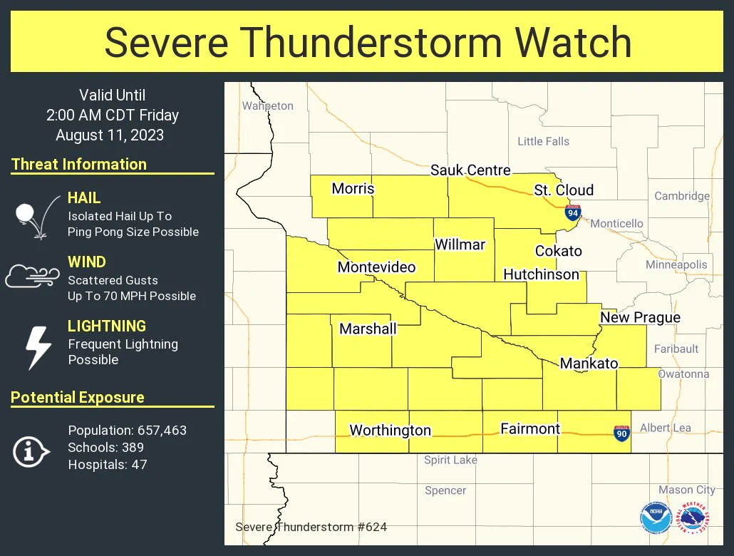
Fig 2. NWS Twin Cities Severe Thunderstorm Watch valid until 2:00 AM CDT.
A severe thunderstorm watch has been issued for the following central Minnesota counties: Pope, Kandiyohi, Renville, Sibley, McLeod, Meeker and Stearns. Again, this watch will remain in effect until 2:00 AM CDT. The primary concerns are large hail up to ping pong ball size, winds up to 70 mph and frequent lightning.
These storms are currently making their way into Pope and Douglas counties as of 9:00 PM CDT, and will likely enter our central counties by 10:00 PM - 10:30 PM CDT. Our eastern counties will likely start seeing storm activity around 11:00 PM CDT to 12:00 PM CDT. Storms should exit the area by 1:00 AM - 2:00 AM.

Fig 3. Mesoanalysis courtesy of the Storm Prediction Center. CAPE (storm energy) values are indicated by red lines.
Looking at mesoanalysis from the Storm Prediction Center, these storms are tracking toward areas of lower CAPE or available energy for storms to use as they enter central Minnesota. Storms like these however tend to tracking along the gradient of highest to lowest available energy in the air. This gradient is currently located right through central Minnesota so I really see no reason for these storms to weaken or discontinue before they hit our area. I would expect them to begin tracking more southeasterly as they get further east though given the orientation of said gradient.
It will be very important to keep an eye on radar over the next few hours as they storms roll through and have a way of receiving alerts from the NWS Twin Cities should they issue any severe thunderstorms warnings associated with this line of storms.
The last thing that I do want to mention is that the tornado threat from these storms is extremely low, hence the primary threats are damaging winds and large hail.
Precautions you can take for these storms includes parking underneath an overhang, carport, or in the garage to avoid vehicular hail damage. Hanging plants should be taken down, and shelter should be taken away from any windows during these storms as hail can smash through windows and fallen tree limbs may smash through windows as well.
If you have to drive in these storms take precautions by slowing down and making sure all lights are ON to indicate to other drivers where you are. If you do not feel comfortable driving pull over and make sure you are OFF the road to avoid other drivers crashing into you!
Again...A severe thunderstorm watch has been issued for Pope, Kandiyohi, Renville, Sibley, McLeod, Meeker and Stearns counties until 2:00 AM CDT.

Comments
Post a Comment