September 23rd Severe Weather Discussion
Central Minnesota Severe Weather Discussion For September 23rd, 2023
By Aidan Cera

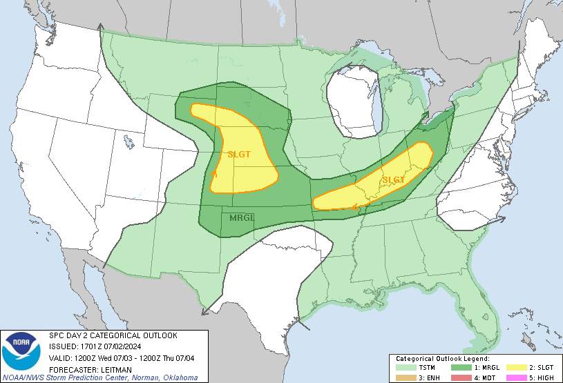
Figure 1. Weather Prediction Center 00Z 23 September Outlook Issued 21Z Friday 22 September.
Good evening central Minnesota. It has been quite sometime since I have made any posts here. My course work for my final year of undergraduate school has been quite demanding, on top of formulating a senior project, forecasting for US Bank Stadium and working 2 jobs. My goal was to upload posts whenever significant weather would be a possibility. Sticking to that promise to myself, tonight is one of those nights where a blog post is likely warranted.


Figure 2. Storm Prediction Center Outlook for Saturday, 23 September, 2023.
The Storm Prediction Center has issued a slight risk for portions of the forecast area for tomorrow, Saturday September 23rd. The severe weather hazards are large hail, damaging winds, and perhaps a tornado or two.
Talking synoptics, an area of low pressure currently located over Wyoming is associated with a mid level elongated shortwave trough over the Rocky Mountains. As this shortwave trough tracks eastward over the next 24-48 hrs, it is expected to acquire a negative tilt, typically for your Upper Midwest severe weather set ups this time of year.
Figure 2 and 3. Figure 2 shows 250-mb Wind and Streamlines models by the GFS for Saturday into early Sunday. Figure 3 shows relative vorticity for the same time frame generated by the ECMWF model.
The associated upper level divergence and advection of 500mb vorticity aloft will lead to a favorable environment for broad scale ascent. This will provide more than enough forcing and lift for several rounds of precipitation to form should the thermodynamics further support rising motion.
Looking at the thermodynamic profiles, it certainly does not appear that low, mid and upper level moisture will be lacking what so ever. Winds associated with the warm sector of the low pressure have been blowing out of south all the way up from the Gulf of Mexico and have thus advected higher dew points into our area. In fact, the NWS Twin Cities is explicitly forecasting dew points to be in the mid 60Fs for Saturday, very atypical for this time of year across central Minnesota.
The GFS Precipitable Water output certainly tells a compelling story, with anomalous moisture profiles overspreading much of the Upper Midwest ahead of the area of low pressure, due to the lack of any disturbances moving across the Midwest advecting the moisture out of the area. As odd as it sounds, the quiet weather we have been having lately is actually going to help this system in the thermodynamic sense.
Given the syntopic and thermodynamic profiles in our area tomorrow, there is very high confidence of precipitation across central Minnesota tomorrow into Sunday. But where does the severe weather come in? As mentioned before, the shortwave trough advecting across the Dakota's tomorrow in it of itself will act as a trigger for severe weather potential given the associated dynamics we often see with negatively tilted troughs.
Figure 5. Illustration using GFS data on the synoptic dynamics contributing to severe weather chances across Minnesota tomorrow.
The troughs negative tilt allows cold air being advecting around the backside of the low to overcut the warm, moist air ahead of the low pressure. The cold air aloft, coming from a more westerly direction, on top of the warm air moving north leads to sharp veering of the winds with height, thus increasing the amount of directional shear and speed shear in the atmosphere. Speed and directional shear allows thunderstorm updrafts to become more vigorous and to survive longer than single cell air mass thunderstorms we are more accustomed to around here.
This process is expected to set up right over Minnesota tomorrow. This, on top of ample moisture supply, resulting destabilization of the atmosphere and broad scale ascent associated with the low pressure tracking across the Dakota's should provide a fairly favorable environment for severe thunderstorm development initially across eastern SD then spreading into Minnesota tomorrow afternoon into the evening hours.
The NAM-3KM Model shows quite an extensive area of showers and thunderstorms overspreading central Minnesota by this time tomorrow. The NAM-3KM, as well as other CAM models such as the HRRR, FV3 Hi-Res and others show ample veering of the winds with height along with favorable thermodynamic ascent for a rising air parcel aided by the broad scale synoptic lift provided by the near by low pressure center. These veering winds and any instability that builds up should allow for long lived stronger thunderstorm to develop or persist across central Minnesota. Given the thermodynamic profiles, all severe weather modes are possible, including large hail, damaging winds, and a tornado or two, especially in our southwestern counties.
Looking at general model guidance, the best time frame for thunderstorms tomorrow appears to be after 5PM and lasting until about 12AM Sunday or so. Storm start and end time will depend on your location across central Minnesota but this seems like a good ball park range to go off of. The bottom line is that environmental conditions are expected to be conducive for severe thunderstorms across central Minnesota tomorrow late afternoon through the evening hours. It will be important to monitor the weather frequently if any outdoor activities are planned. The best place to do this would be to check in with the NWS Twin Cities, the Storm Prediction Center and the Weather Prediction Center.
Outside of the chance for severe thunderstorms tomorrow, we actually have a decent chance to see some more substantial rains across our area tomorrow! We desperately need this rain as all of central Minnesota is in a severe or extreme drought. The Mississippi River is as it's lowest or near it's lowest levels ever recorded, with most of the river being dry near the Beaver Islands in St Cloud.

Figure 7. Weather Prediction Center QPF forecast Days 1-2.
While tomorrow's rain really won't help us get out of a drought since we are so far down the rabbit hole at this point in terms of drought, it will certainly be welcome. The Weather Prediction Center now depicts us seeing up to 3 inches or more of rain tonight through tomorrow night. hopefully this rain will be more steady and not one heavy main event. With how dry our soil is, a heavy deluge will only runoff into the rivers and not actually soak into the ground due to the hardness of the soil. A slow, drenching rain is what we truly need. Tomorrow may not entirely fit that need but it still would be amazing to see any bit of rain we can.
Stay weather aware tomorrow folks, check with the local NWS website for the latest weather information as well as live radar and have a way to receive severe weather warnings should they be issued for your area. Have a great night central Minnesota!
Graphics courtesy of the Storm Prediction Center, the Weather Prediction Center, and tropicaltidbits.com.


Comments
Post a Comment