Nice Weather Followed by the Rain Train
04/25/24 Weather Outlook for Central Minnesota
by Aidan Cera
Good afternoon central Minnesota! There is quite a bit to talk about here locally and nationally with the weather over the next few days, so figured I would just dive right into it and go from there this time around.
Beautiful Weather Today
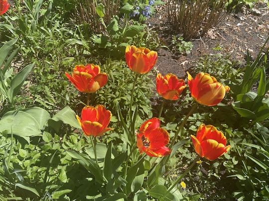
Looking out the window at the current conditions, we have plenty of sunshine across central Minnesota with winds a bit breezy out of the Southeast between 15–25 mph. Temperatures are solidly in the mid to upper 60ºF's across all of central Minnesota with even a 70ºF or two in Renville county. Thinking highs for most of the area today will be near 70ºF based on current observations, and those winds are going to keep on whipping as the pressure gradient associated with our incoming storm system tightens. Not expecting any rain today, cloud coverage should increase by the end of the day today though as moisture in the upper and mid levels of the atmosphere begins to surge northward.
Rain Begins Tonight (For Some)
Low level moisture will begin working its way into Minnesota tonight as the low level jet kicks in from the south. Partly cloudy skies early on will allow temperatures to drop into the 40ºF's across the area before cloud cover becomes more widespread from southwest to northeast. When it comes to when the rain arrives, there is a bit more uncertainty. Atmospheric profiles show plenty of dry air at the lower levels of the atmosphere which will prevent much of central Minnesota from seeing any rain that actually reaches the ground overnight. Our far south western counties such as Renville county will have the best chance for seeing any precipitation as we approach dawn. There will likely also be some elevated instability to work with so do not be surprised if there are a few rumbles of thunder closer to down in our southwestern areas.
Rainy Friday or Does it Hold Off?
When it comes to Friday, precipitation prospects do not appear to be what they were two days ago. We will still likely see rain across a decent chunk of the area, it is just a matter of when the best chances will be.
I mentioned that dry air will be hanging on at the surface earlier in this discussion, and that could continue to be the case through Friday morning. Models differ significantly on if the forcing associated with the incoming low will produce enough precipitation to mix that dry air out or not. The mesoscale models show very little precipitation north of I-94 during the day on Friday, while the global models are singing a different tune, with a nice morning round of showers and embedded thunderstorms making their way through the area. Given the overall environment, I have a hard time believing we get away with no rain tomorrow morning for most of the area and instead think a weaker morning round of showers and storms will be possible starting around sunrise for our southwestern counties, more mid morning for our northern counties.
Additional shower and embedded thunderstorm development is expects as dry air is almost certainly mixed out by Friday afternoon and the low pressure approached from the southwest. The best chance for widespread precipitation appears to be later Friday afternoon through Friday night for all of central Minnesota associated with the passage of the low pressure. There is also expected to be some decent instability at least in the mid levels of the atmosphere, which will aid in thunderstorm development across the area in front of the low.
Concerning precipitation amounts for this system Friday into Saturday morning, there is a large dependence on how much rain falls Friday morning. Global models are higher in terms of precipitation amounts, with most of central Minnesota seeing at least half an inch of precipitation, with isolated 1" areas, especially in our southern counties.
It will be quite windy during this time period, with wind gusts exceeding 40 mph at time for portions of our area, especially in our flatter counties.
Temperatures on Friday will climb to about 50ºF by the looks of things now, with some areas potentially struggling to reach 50ºF with more rain cooled air. Temperatures aren't going to drop too much tonight thanks to the cloud cover, with lows around Friday's highs. In fact, it is possible temperatures warm up into the low 50ºF's as the low passes through and brings surge of warmer temperatures north ahead of and with it.
Severe Weather Risk Stay South
Concerning severe weather, central Minnesota doesn't need to worry. The severe weather threat for Minnesota is confined to the far southern portion of the state (I-90 corridor). Once you get down to Iowa, however, the severe threat increases substantially. In fact, significant tornadoes are looking possible for portions of central, western, southwestern and southern Iowa Friday as the low pressure makes its way into the region. Atmospheric profiles look about as favorable as they can get, so if you have any plans to travel to these areas tomorrow, beware of significant severe weather potential!
Soggy Weekend Overall
Saturday morning widespread rain associated with the low still looks likely till late morning and early afternoon for our more northern counties. Widespread rains should exit the area between 10AM to as late as Saturday evening for our northern counties. Highs will climb a little higher than they do Friday, ranging from low 60ºF's in our southern counties to around 50ºF for our northern counties. Would not be shocked if there are a few peaks of sun down there as well, but I wouldn't get my hopes up.
A break from the rain arrives Saturday Night as we are under the calm between two storms. Sunday morning we should still be more on the dry side under cloudy skies and chilly temperatures, especially for our northern counties. I would not be surprised if temperatures struggle to reach 40ºF across Crow Wing, Cass and Todd counties thanks to cold air making it's way south on the backside of the first low. Temperatures will warm the further south you go, with the warm front expected to be draped across far eastern and southeastern Minnesota and highs in the low 60ºF's for the areas under the front.
Rain is expected to make its return Sunday afternoon into Sunday Night as the next area of low pressure tracks through our local area. It will once again be quite windy as the low moves through, with gusts over 30 mph for most locations at the least. Not the most conducive conditions to be carrying an umbrella :(
Concerning severe weather on Sunday, I think most of our area should be in the clear. I think general thunderstorms will even struggle to materialize due to the cold temperatures we will see closer to the low. As a result, most of the severe weather will be in the far eastern and southeastern side of the state.
Rain totals are still up in the air. Again, global models and mesoscale models are butting heads over where the heaviest axis of precipitation sets up across the state. Mesoscale models show very little rain for central Minnesota at all, with a better chance for snow mixing in than anything else, while global models show a much warmer scenario of all rain and plenty of it, with rain totals potentially exceeding 2" from Saturday Night through Monday morning. I think the best bet for this scenario is play the middle ground. Rain certainly seems likely, the matter of how much is not something we will know until the event gets closer.
Unsettled Weather Early Next Week?
Looking more longer range, models show a continuous train of low pressure systems making their way through the area through next week as a persistent trough sets up along the west coast of the United States and a high pressure sets up over the southern Plains. This should put us in the crossfire of several lows riding the northern periphery of the ridge.
There seems to be a good chance for showers and thunderstorms going into Tuesday as a low pressure system makes its way through. Temperatures will likely warm into the 60ºF's again in between systems next week thanks to the high to our southwest. Another storm system looks possible toward the end of the week, but by this point we are looking quite a ways out, so details will change between now and then.
In summary, we are in for a busy next week or so when it comes to rain. Certainly a time to pay attention to the weather if planning anything outdoors! Tomorrow and Saturday are going to be hectic days for me, but hopefully I can upload another post sometime tomorrow. If not, have a fantastic rest of the day today and have a great start to your weekend!


Comments
Post a Comment