July 19th Central Minnesota Weather Discussion
July 19th Central Minnesota Weather Discussion
By Aidan Cera
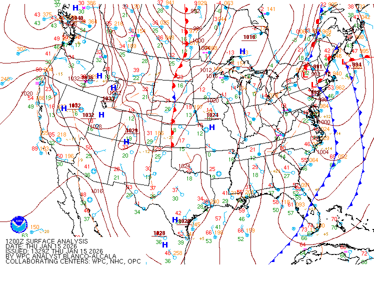
Good afternoon central Minnesota. This discussion is going to be the more brief side since thinking really hasn't changed a lot with regards yesterday's discussion other than many areas are much less likely to see rain this afternoon than before. Yesterday I discussed that it all comes down to two things, 1.) when the cold front comes through and 2.) how much dry air is lurking around.
Addressing the question of cold front placement, timing has been postponed slightly which means the cold front is further west than I anticipated it being by this time. This works to our advantage to see some thunderstorm activity this afternoon across a decent chunk of central Minnesota. However, drier air seems to be outracing the cold front as many mesoscale models have been predicting since yesterday and should advance across much of central Minnesota before convective initiation takes place. It is worth noting however that some models show a weak surge of moisture along the cold front despite the drier air working in ahead of the front, which may be enough to bridge the gap between the temperature and dew point slightly and provide a more favorable environment for thunderstorm development.
This all comes down to perfect timing, placement and other dice falling into a strict order however, and as we know any game of dice is always one heck of a toss up (haha get it?). Therefore, I don't see any reason to complete eliminate the chance of storms completely (especially for our eastern and northern counties) but I don't see any reason to put a high chance of storms either. Thinking a 30% chance for our western counties and a 40%-50% for our northern, eastern and southeastern counties with cities such as St Cloud, Willmar, Alexandria down toward Renville having the lowest chance.
Any thunderstorms that do develop have a fair shot at becoming severe according to the National Weather Service (NWS) and the Storm Prediction Center (SPC).
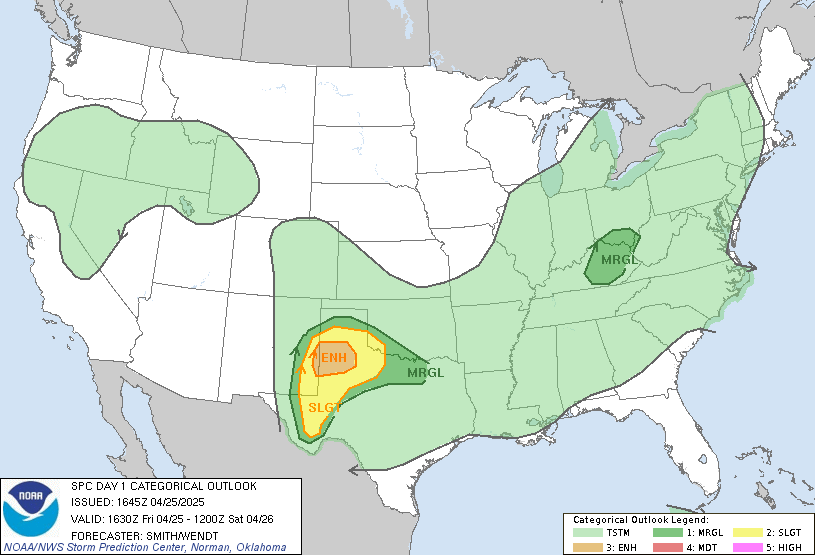
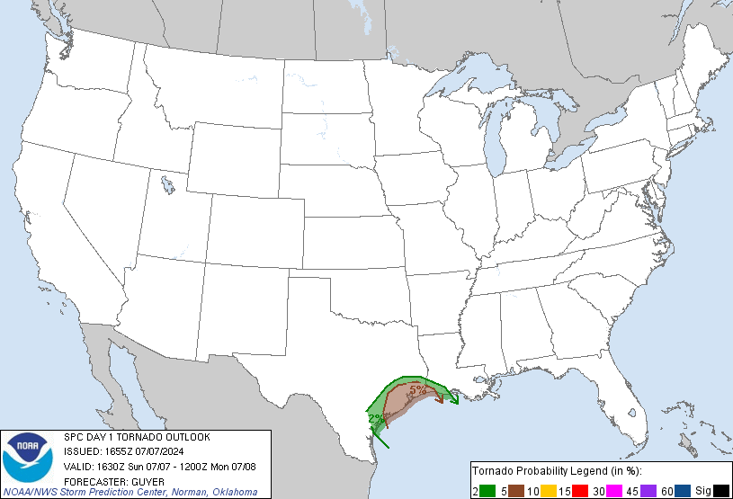
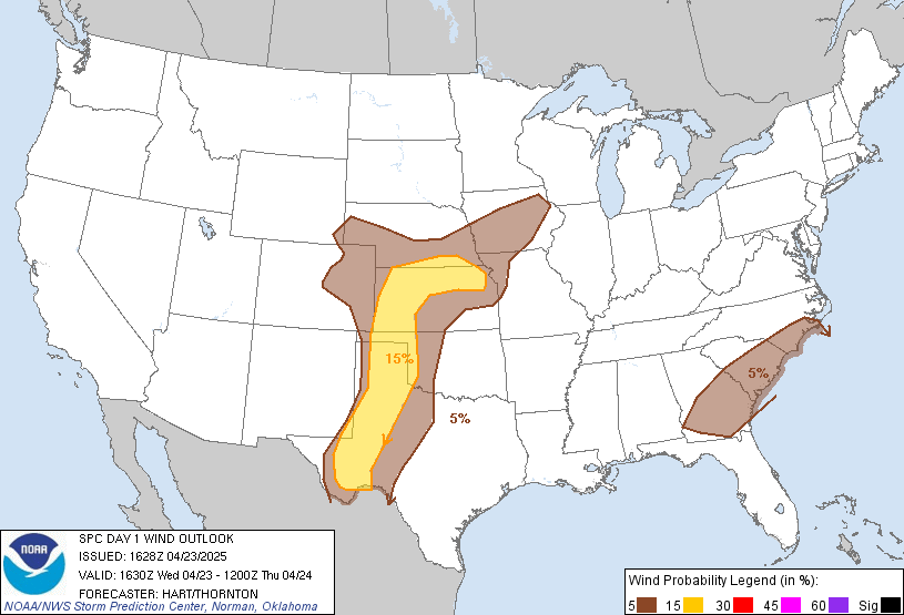
Figure 2. SPC Severe Weather Outlook issued 1621Z July 19th, 2023.
All severe hazards are possible, including the risk for damaging winds (15%), very large hail (15% Hatched) and a few tornadoes (5%). Given the question of just how close dew points will be to the surface air temperature and how steep the lapse rates are, I think the biggest threat for central Minnesota will be the risk for elevated hail producing supercells, very similar to last Thursday. Even though odds are low across much of central Minnesota to see any storms today, it will be important to keep a close eye on the sky and radar for any storms that do develop.
Temperatures today are going to be warmer with highs in the upper 80Fs across most of the area and dew points in the low 60Fs. Tonights lows dip to around 60F under clearing skies. Tomorrow looks much cooler with highs only getting into the upper 70Fs under mostly sunny skies and and somewhat breezy conditions with winds 10 to 15 mph out of the NW.
Through the remainder of the week, through the weekend and into next week, we are watching the potential for a more summer like pattern building back in again with high pressure over the Central United States feeding warm and likely more humid air around it's periphery. Models are still a little shaky with just how far north this ridge builds and therefore there is much uncertainty on just how warm it will get and what the precipitation chances will be if there are any at all. I am currently expecting highs at least in the upper 80Fs to lower 90Fs across most of central Minnesota by the beginning of next week with dry conditions through the end of the week and weekend. Any chances of storms doesn't return until middle of next week.


Comments
Post a Comment