August 7th 2023 Central Minnesota Weather Discussion
August 7th Central Minnesota Weather Discussion
By Aidan Cera

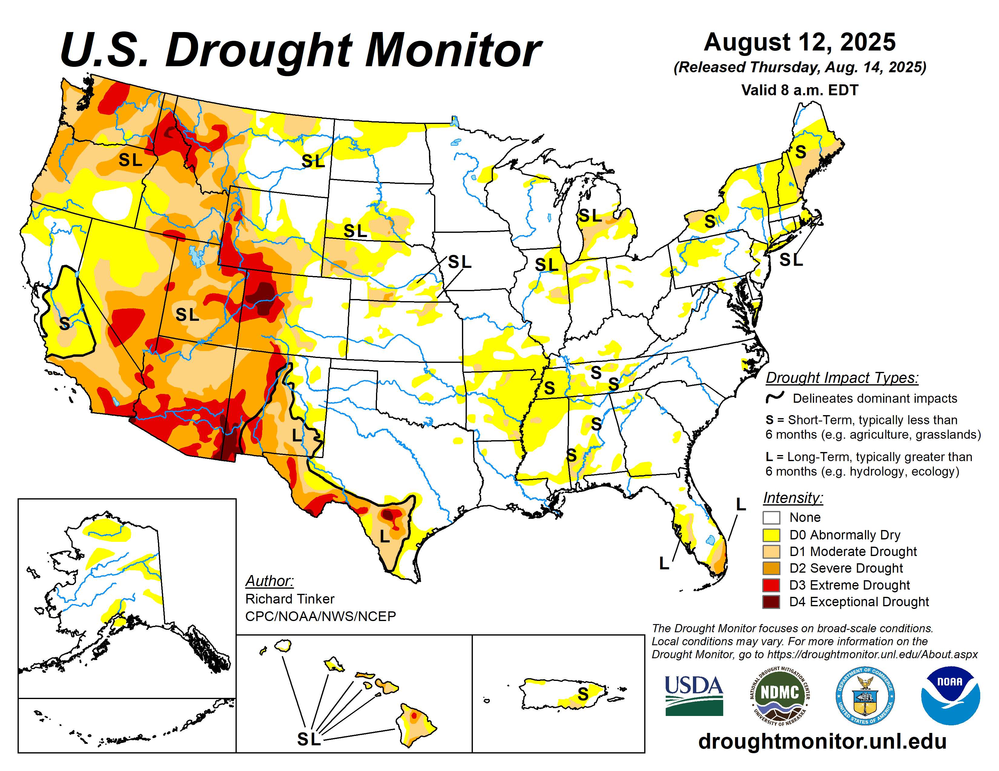
Another week has gone by, and the drought only continues to grow across Minnesota and the Midwest as a whole. What seemed to be a promising rain this weekend fell apart on us, not all that surprisingly, and I really don't see any legit change of much rain in the coming days or weeks as we wrap up the final few weeks of the driest or one of the driest summers on record across central Minnesota. Unfortunately I suspect this is going to become the new normal as oceans and the poles continue to warm weakening the temperature gradient between the tropics and the poles, making it more difficult to come by potent synoptic scale systems that bring us more widespread rain. Going forward I think it will be reasonable to expect severe drought every summer from here on out.
If there is any good news, it is that temperatures are expected to be slightly cooler than they were last week, with high temperatures across all of central Minnesota in the low to mid 80Fs through pretty much all week. Even cooler temperatures arrive next week. The best chance of any rain (although not a good chance) is Thursday Night.
Today and tomorrow will be on the pleasant side with highs in the low to mid 80Fs and plenty of sunshine.
Toward midweek, a more "active" pattern is being outputted by the modeling in terms of the 250mb jet level.
Currently there is a synoptic weather system south of the Gulf of Alaska associated with a shortwave trough. As time progresses, both the EPS and GEFS system indicated a ridge of high pressure amplifying ahead of this system and propagating eastward toward the United States west coast. By midweek, the ridge could lead to a new amplifying shortwave trough advecting across the Pacific Northwest and into the Rocky Mountains region, acquiring a negative tilt as it progresses.
By Thursday, this negatively tilted trough will be advecting into the Dakotas and by Friday it will be propagating across Minnesota. Given the shortwaves negative tilt, forcing is likely to overspread the area by Thursday afternoon into Thursday evening. This forcing along with the expected development of a low level jet associated with the negatively tilted trough will likely lead to the development of at least some scattered shower and thunderstorms across the area. Of course though, as has been the case all summer, there are several flies in the ointment of this possibility.
Fig 3. Same as Fig 2 but of North America with flow patterns drawn in red.First off, looking at the synoptic pattern, we have no clear source of moisture return from our south. There is a ridge of high pressure well to the south being squashed into Texas and the Gulf of Mexico by the abnormally southerly subtropical jet. The shortwave associated with the jet over Nebraska and Kansas along with no appreciable high pressure to our southeast bringing warmer more tropical air up with it from the south means that the negatively tilted trough will likely not have much moisture to work with. Therefore, we can rule out any chance at widespread rainfall from this system. We also can see the east coast troughing that we have seen all summer prevailing meaning that the negatively tilted trough may not even materialize thanks to continuous northwest flow behind the trough.
There is a lot of complexity to this dynamic, but there I definitely would not get my hopes up for any precipitation despite a better looking synoptic pattern. I would say that we have a 30%-40% chance of actually seeing any precipitation overall but miracles happen everyday so we shall see.
Severe weather likely won't be an issue given the timing of this system. Any storm chances won't likely arrive till after sunset most likely given the maximum convergence ahead of the shortwave trough arriving in our area Thursday Night. Daytime instability will likely be cut down as a result by that time but I still would expect enough instability to fire some scattered thunderstorms.
Nothing else really of note for this discussion. Plenty of sunshine today with highs in the low to mid 80s, same tomorrow and Wednesday.
Hope everyone has an excellent start to the work week and I'll talk to you all next time.


Comments
Post a Comment