June 8th Central Minnesota Weather Update
June 8th Central Minnesota Weather Update
by Aidan Cera

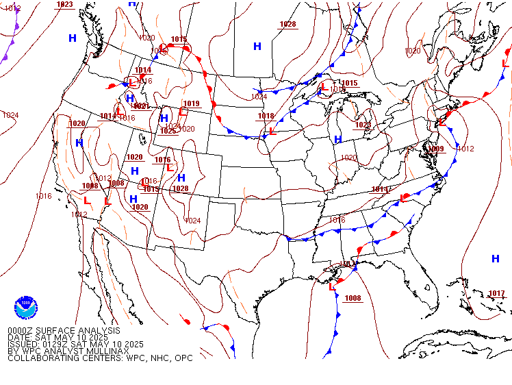
Figure 1. Weather Prediction Center surface frontal analysis valid 2100Z Thursday June 08 2023.
Today was another fantastic day across central Minnesota with highs topping off near 80F with dew points in the more comfortable range. Skies where mostly sunny and a light breeze topped off a generally perfect day. This beautiful weather was courtesy of a surface high pressure system located around the Iowa/Wisconsin/Minnesota border as shown in the map above.
Figure 2. Radar imagery valid around 0230Z, Thursday, June 08, 2023.
Looking at radar, there is a complex of thunderstorms across eastern North Dakota extending down into South Dakota. These storms have been tracking generally southeast over the last couple of hours but are moving rather slowly. While these storms are approaching Minnesota, their slow movement and loss of daytime instability will likely lead to them falling apart long before they reach central Minnesota. I do expect some increase in cirriform clouds overnight tonight into tomorrow as the remnants of this storm complex makes its way through.
I am expecting a cooler night ahead for central Minnesota due to the lack of an appreciable low level cloud cover that would act to prevent much surface cooling. As a result lows will likely bottom out in the mid to upper 50Fs. Winds will be light at 5 mph out of the E.
Tomorrow skies are expected to be generally partly cloudy but may end up being more clear depending on how long the remnant upper level cloud deck persists. Highs are expected to top out in the lower 80Fs with dew points in the low to mid 50Fs. So overall a very comfortable day once again.

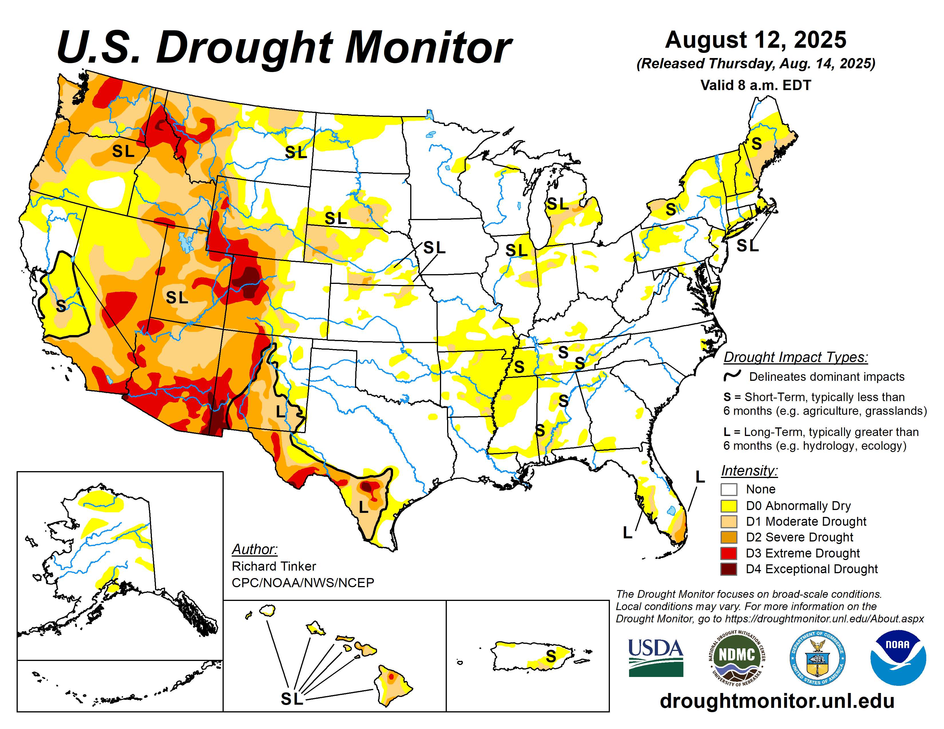
Figure 3. Climate Prediction Center drought monitor map updated June 6th, 2023.
While the dry weather may seem nice as of late, we are beginning to approach a point where it is becoming quite an issue across much of the central United States including central Minnesota. Unfortunately some portions of central Minnesota are now in a moderate drought, and although not surprising, this is generally grim news. This is the 4th summer in a row that some portion of central Minnesota has found itself in a moderate drought or a drought more severe. Too add to the bad news, there are so real appreciable widespread rain chances for the area in sight and I really do not expect this to change within the next week or two. It does certainly seem another bad drought is in store for central Minnesota that I don't anticipate going away by the end of summer.
Going forward any rain chance we have will be one to look forward to for the sake of those who need water to get by, such as farmers.
Fortunately, while not a widespread chance of rain, there is a small chance of rain going into the weekend as a cold front tracks across Minnesota from the northwest.
Timing wise, the models seem to be narrowing on the cold front passing through central Minnesota around midday. Model soundings look decent for precipitation, yet models generally show most of the shower and thunderstorm activity not initiating until after the front passes through a fair chunk of central Minnesota. Not saying that this will be the outcome as computer models are simply projections of what *could* happen, not of what will happen. Therefore I have not eliminated the chance of precipitation although and expected many locations to see at least a few brief periods of rain when all is said and done.
Highs are expected to top out in the mid to upper 70Fs across much of central Minnesota with winds shifting to the northeast after the cold front passes through with speeds of 5 to 15 mph.
Even cooler temperatures appear in store after the cold front passes through with a even lower dew point range. As high pressure builds in, very pleasant weather both sunshine and temperature wise is expected Sunday into early next week.
In summary, generally pleasant weather lies ahead with a more minimal rain chance on Saturday and more pleasant weather for the latter part of the weekend and early next week. We really are starting to become more desperate for some appreciable rain though, hopefully the pattern change some longer range models are expecting toward the end of the next week may help out drought situation. I won't go into too many details just yet but more updates will follow. Have a great evening and happy Friday everyone!
Central Minnesota's general forecast is below...


Comments
Post a Comment