June 30th Central Minnesota Weather Discussion
June 30th Central Minnesota Wx Discussion
By Aidan Cera
Happy final day of June central Minnesota! Many folks are likely disappointed that we are already past the first month of summer and the summer solstice, which means days are getting shorter again and winter is on the way...but hey, you really don't notice the days getting shorter till August and temperatures start getting colder till September so we have a LONG ways to go till any of that :)
To be entirely honest, I'm not all that worked up about seeing the backside of this month because, from a weather perspective, this month has been horrible in terms of air quality, smoke and dry weather.

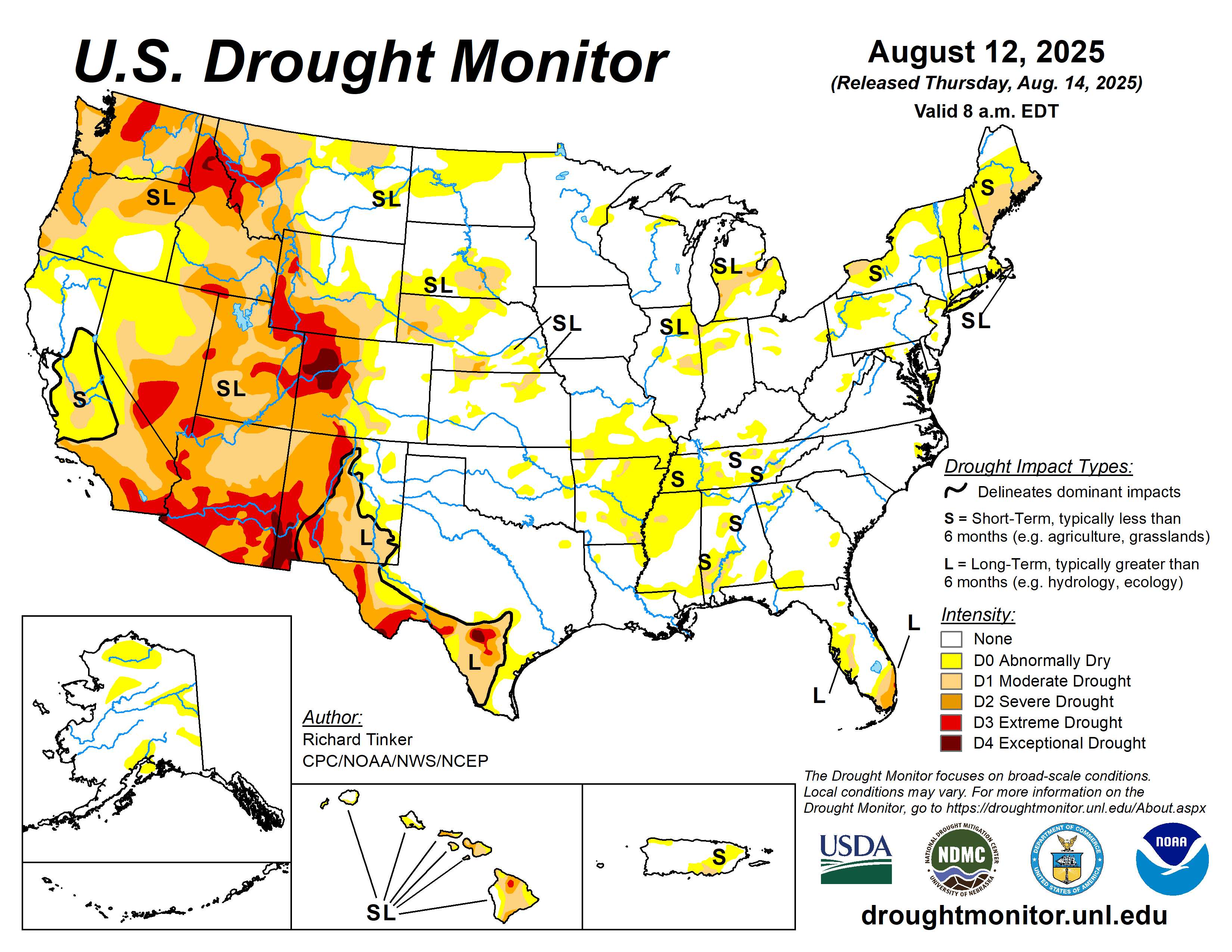
Figure 1. Climate Prediction Center United States drought monitor, updated June 27th 2023.
Unfortunately, drought has overtaken much of the Midwest and Great Lakes region this month as continuous anticyclonic blocking as kept any well defined troughs from advecting through the area from Canada. The Canadian wildfires have also kept instability levels relatively low across the region due to smoke dispersing more of the sun's radiation, leading to cooler temperatures and thus less instability. So whenever we actually do get a weather system come through the area, instability is lacking so not much really happens.
The Canadian wildfires have also lead to us being under air quality alerts for most of the month due to smoke, thick at times near the surface leading to hazardous conditions for not only those with health complications but the general population. Add high surface ozone levels to the equation and this month has just been blah at best.
These factors likely have a lot of folks asking...will July be any better? The answer.........I wouldn't get my hopes up too much.
Let's start though with looking at the weather for the last day of June and the first few days of July. Today looks dry across central Minnesota with warmer temperatures than we saw yesterday and a bit more cloud cover possible. A Mesoscale Convective System tracking to our south has lead to some more upper level cloud cover but we'll also see some lower level cumulus clouds build in heading through this afternoon. Highs are expected to be in the mid to upper 80s generally with a light NW wind of around 5 to 10 mph.
Heading into tonight, dry conditions are expected with some clouds and lows in the low to mid 60Fs. Winds are expected to be light at 5 mph out of the N.
For the weekend, things look dry once again with very warm temperatures each day, with highs in the upper 80Fs generally on Saturday and highs in the low to mid 90Fs on Sunday with even warmer temperatures arriving for Monday. In fact, I think Monday may be our first legitimate chance to crack 100F if other weather conditions such as relative humidity and wind align just right. Winds are expected to be relatively light during this period so yes, I think some very hot temperatures possibly up to 100F are certainly likely. Also, surprise surprise, no chances of rain during this time period. Yay I know.
The good news is while it is still expected to be hot through the middle of next week, rain chances returns for the 4th of July, which looks to be our next best chance at widespread rainfall, although it is way too soon to near down any specific details on where and when this rain will take place. Globals models are in fair agreement on a positively tilted trough advects from the west and acquires a more negative tilt as it approaches Minnesota. Negatively tilted troughs are usually our best chance to see widespread rainfall as well as severe weather, so this is something I will be watching closely in the coming days. For now though, hot and dry the next 3-4 days, so get that sunscreen out and crank up the AC!
Now, going back to the question of earlier...is July going to be ANY better than June? Possibly, then again June didn't really set a high bar so it won't be too hard to have a "better" July even if it is still less than satisfactory.


Figure 2. Climate Prediction Center 6-10 Day Temperature and Precipitation Outlook.


Figure 3. Climate Prediction Center 8-14 Day Precipitation and Temperature Outlook.
The Climate Prediction Center is fortunately predicting wetter than normal conditions across much of the Midwest and Great Lakes region, which is good news for us at first glance. Thing is though, predicting summer precipitation at a 2 week time frame is next to impossible seeing as things can change so quickly in regards to nature of any shortwaves that track through. Considering this, I'm not really buying into the idea that we are going to see above normal precipitation, but we can still hope. Tomorrow, some of the most accurate long term models will be run for the month of July so we'll have that input to work with as well, which I will likely put into the next weather discussion.
Other than that, I really don't have much else to add with concerns to local weather. The general forecast, as always, it posted below. Have a great last day of June everybody and I'll talk to you in a day or two!


Comments
Post a Comment