June 19th Central Minnesota Weather Update
Central Minnesota June 21st Wx Discussion
by Aidan Cera
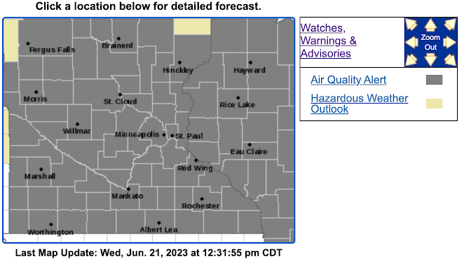
Good afternoon central Minnesota! It has been very hot this week across the area with some of warmest highs reached yet this summer. We have also been under an Air Quality Alert across most of Minnesota due to some ground level ozone accumulating at the surface. This Air Quality Alert is in effect until 9PM Thursday CDT. Folks with underlying health conditions such as asthma and COPD should be cautious when having to spend a longer duration of time outside.
Fig 2. GOES-16 Water Vapor imagery loop of the United States from around 1530Z to 1745Z June 21st 2023. Loop courtesy of tropicaltidbits.com.Looking at current water vapor satellite imagery, we can see some decaying thunderstorms across Kansas, Nebraska and the Dakotas. These thunderstorms are associated with a trough at the 250 mb level draped across the western United States extending into Canada. We can also see a cutoff low over the southeastern United States as seen by the high moisture content and convection wrapping around the eastern side of the center along the east coast and Appalachian Mountain region. There is also some very dry air wrapping around the backside of the low coming down from the upper Midwest and Great Lakes region extending down the Mississippi River Valley. This low humidity channel is the reason we have had abundant sunshine the last few days across Minnesota.
Fig 3. GFS MSLP 700-300 mb Relative Humidity % and 700-300 mb Wind from 00Z June 20th through 12Z June 21st 2023, loop courtesy of tropicaltidbits.com.We can see the much drier air wrapping around the northern and western end of the cutoff low to the southeast. We can also see some more moist air being advected northeastward to the west in associated with the upper level trough.
The main thing that we will be paying attention to in the coming days is how this cutoff low and trough interacts. All models depict the cutoff low dying off and advecting eastward allowing the trough to our west to slowly advect eastward over the next several days. The sample model run below in Fig. 4 shows the GFS's depiction of the trough advecting eastward.
As this trough advects eastward, a negatively tilted trough is expected to develop across North and South Dakota. The trough then advects eastward across Minnesota. During this process, the model also depicts high amounts of moisture streaming across the area. Given the negatively tilted trough and the forcing that it will provide on top of all the moisture expected to be present in our area, I would expect widespread coverage of showers and thunderstorms as we head into the first half of the weekend at times across central Minnesota.
Given previous model runs it seems the best forcing is going to around Saturday into Saturday Night, but there will likely be chances of showers and thunderstorms in the area starting tomorrow afternoon and lasting through the weekend given the higher precipitable water values and higher humidity values across central Minnesota.
In summary, we are FINALLY looking at a legitimate chance of widespread and much needed rainfall across our area!!! More details will come before the weekend, but it makes this heat more bearable when knowing that precipitation chances are on the horizon.
What about severe weather chances?

Fig 5. Storm Prediction Center Day 4 Outlook issued June 21st, 2023. Valid for Saturday June 24th.
The SPC has highlighted an area of elevated severe thunderstorm risk for southwestern and southern Minnesota for Saturday, June 24th. They highlight that there is a 15% chance of severe thunderstorms with high winds, large hail and tornadoes being a risk as cyclogenesis is expected to lead to veering winds with height (directional shear) and changing wind speeds with height (speed shear). These conditions are favorable for supercell development initially. Central Minnesota counties such as Kandiyohi, Meeker and McLeod will have the highest chances of seeing severe weather if this forecast holds true through the coming days. We will certainly continue to monitor the progress of this system in the coming days and I will hopefully have daily updates in the meantime.
Taking a brief look at weather conditions today and tomorrow though, plenty of sunshine is expected today with highs in the upper 80s and lower 90s. Winds will generally be out of the S until a weak cold front passes through tomorrow evening providing a slight chance at some scattered thunderstorms across the area, especially in our western and northwestern counties.
The general central Minnesota forecast is shown below.


Comments
Post a Comment