Soggy Sunday, Spotty Storms for Memorial Day
05/26/24 Weather Outlook Southeastern Wisconsin
by Aidan Cera

Memorial Day weekend has been a mixed bag thus far. Saturday was fantastic across southeastern Wisconsin with mostly sunny skies and temperatures well in the 70ºF's away from the lake. Sunday, today, so far has been a vastly different story. Temperatures have struggled to or have yet to reach 60ºF across most of southeastern Wisconsin with rain falling for the last few hours.

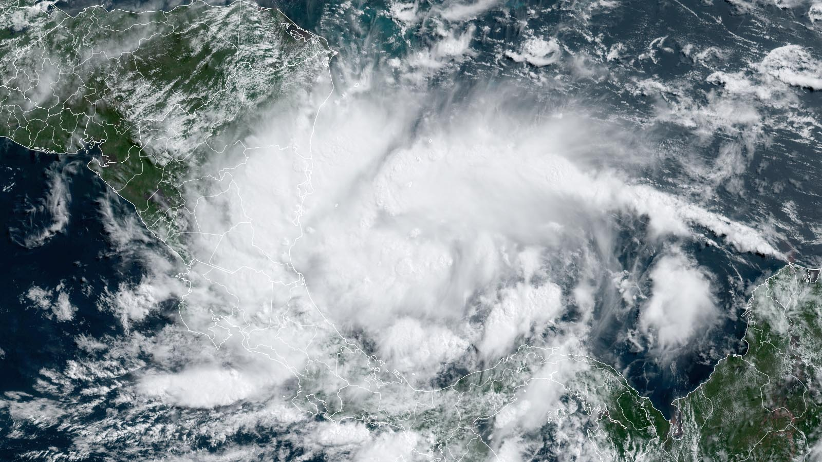
Rain showers associated with a strong advance of warm air north (warm air advection) and a fair amount of mid level atmospheric spin (vorticity) are making their way out of the area to our northeast and north as we approach mid afternoon. Plenty of clouds are hanging around but there seems to be some clearing taking place in far southern Wisconsin, especially over Walmworth, Rock and Green Counties, creeping its way into Waukesha and Jefferson Counties. Behind this clearing, a new line of showers is developing across Lafayette County working eastward.
Looking at surface analysis, it appears there is a cold front associated with this new line of showers given the the change in wind direction from the southeast to the west. There is decent vorticity associated with this cold front since it is located so close to the low pressure center (located over Grant and Iowa Counties it seems). This, along with decent analyzed shear profiles and just enough sun ahead of the storms acting to increase destabilization slightly, is the likely the culprit for these new showers. The question is will this area strengthen further as some mesoscale models show or will it just fizzle out as most mesoscale models show?
I feel the safest bet is to keep a chance of showers and a few thunderstorms around through the evening with this boundary passing through. It is never safe to assume no rain when we are located so close to the primary source of vertical forcing (low pressure center). Temperatures are not likely to climb all that much today unless the sun comes up, which may be able to get surface temperatures into the mid 60ºF's briefly.
Given the shear, there is a slight chance of a few severe storms later this afternoon into the evening hours. The SPC has issued a Marginal Risk of severe weather for portions of southeastern WI, primarily south of I-94. Hazards include large hail and damaging winds, along with frequent lightning.
Severe weather potential will drop off toward sunset and the further east and north the storms get due to distance between the warm front and lose of destabilization once the sun goes down. Again, this chance is relatively low and probably best out toward Dane, Green, Walworth and Jefferson County. Therefore big population centers such as Milwaukee shouldn't need to worry too much about severe weather.

Skies will remain mostly cloudy overnight tonight due to our proximity to the low pressure. This should keep our lows from dropping too much overnight. Expected lows are in the mid 50ºF's across all of southeastern Wisconsin.
For Memorial Day, it really is a mixed bag. I certainly do not think it will be cloudy all day, I think there could be a fair amount of sun, but there also will a chance of showers and a few weak thunderstorms in the area, especially during the afternoon if there is sun. If there isn't much sun, there likely will not be much in terms of precipitation in our area. Highs are expected to be around 70ºF with winds out of the NW behind the low.
I generally think Tuesday is going to be generally the same story, with some morning sun and clouds giving away to afternoon showers and weak thunderstorms if enough instability is able to work its way into the system. Highs will be cooler however, given continues cold air advection Monday night into Tuesday on the backside of the low. Highs are expected to be in the mid to upper 60ºF's early on, with a lake breeze kicking in later in the day cooling lakeside areas into the 50ºF's. This lake breeze may either help to spark showers and storms Tuesday afternoon or limit the storms depending on how boundaries interact with the overall environment. Generally, chances for storms on Monday and Tuesday is about 40%-50%, thanks to multiple shortwave troughs passing through providing enough forcing to get convection if instability is in place as well.

Weather seems to calm down a fair bit going into the middle of this week. High pressure will work its way in from the west and stall over Wisconsin through the first half of next weekend. Temperatures are really going to struggle to warm much from day to day until next weekend, with highs in the mid to upper 60ºF's for most of the week ahead. A trough of low pressure will dig into the western portion of the US and it's associated precipitation will likely stall out across the Dakota's and Minnesota through most of the the end of next week. Therefore, Wednesday through Saturday seems to feature plenty of sunshine with mild temperatures slightly below average for this time of year at the very least.
There may be a return of shower and storm chances by this time next week, but the uncertainty regarding this next system is way to high to make any firm predictions at this point.
The bottom line is storm chances continue today, along with Memorial Day and Tuesday, although the nature of these storms will be widely scattered and not make any of the next 2-3 days a washout. After Tuesday, the week turns more pleasant with more sunshine and slowly warming high temperatures, with 70ºF's returning for next weekend.
Happy Memorial Day everyone, be sure to remember the sacrifices many have made to keep us the great country that we are and to have our freedoms, even the freedom for me to type this forecast and the freedom for you to read it!


Comments
Post a Comment