June 23rd Central Minnesota Weather Update
June 23rd Central Minnesota Weekend Forecast
By Aidan Cera
The weather forecast for this weekend starting today is fairly complex and subject to much variation in terms of temperatures and rainfall amounts. These variations are leading to some margins of uncertainty with how warm highs temperatures will get which is further dependent on who gets rain and who doesn't. By tomorrow everyone is likely to see rain at some or multiple points in the day, but even then the question is how much does this rain impacts high temperatures and how much rain do certain areas receive. There really is not an easy answer to these questions therefore the high temperature ranges are a bit wider in this forecast.
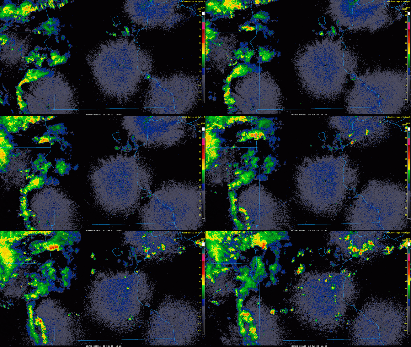
Fig 1. College of DuPage current radar valid at 1853Z June 23rd 2023.
Starting with the current conditions, we do have some altocumulus clouds drifting across the skies indicative of mid level instability. Thunderstorms are also beginning to fire across central Minnesota but remain widely scattered for now. There is plenty of sunshine though and once again, assuming no thunderstorm coverage till later this afternoon, we are in for a hot day with highs in the mid 80s to low 90s. We aren't going to have much a breeze either, only out of the SSW at around 5 to 10 mph. The one positive is that clouds are likely going to increase today regardless of where rain sets up due to cloud debris from decaying thunderstorms, so there will be quite a bit more cloud shading than we have had the last few days. A negative though is the dew points are in the mid 60s currently and will likely climb into the upper 60s as we head into the afternoon, so it will feel quite uncomfortable out there. It will be important to drink plenty of water if you are planning on partaking in any outdoor activities. Personally I have gone through about 8 bottles of water a day which is likely a bit excessive but given that I work outside and am sweating heavily constantly...probably for the best haha.
Tonight temperatures are going to dip a little further down than what we have seen the last few days with lows in the lower to upper 60s depending on who sees rain and who doesn't.
Saturday is a wild card temperature wise. Some areas may see temperatures only climb into the mid 70s depending on when storms roll through and how long they last. Areas who see more rain especially around midday will likely see lower high temperatures. My forecasted highs range from 74F to 82F. I know that is quite the range but again, the rain is going to make it tricky and it all depends on when that rain takes place.
Fig 2. GFS 2 meter temperature forecast from 3 days ago to 3 days from now. Note the above normal temperatures indicated by red followed by the colder than normal temps behind the low moving through this weekend indicating colder than normal temperatures. Finally some relief!!! Loop courtesy of tropicaltidbits.com
Sunday temperatures are going to be even cooler with highs likely only making it into the low to mid 70s due to rain chances and NW flow on the backside of the low pressure that is expected to pass through. Due to this storm system, however, temperatures are expected to be much more pleasant next week with highs near our average of 80F degrees so the heat is almost over! Only one more day guys!!! We can do it!
Now let's talk this rain chance I've mentioned several times already. What sets this rain chance apart from all the other chances we have had thus far this summer is that it looks to be a widespread chance, not a hit or miss, feast or famine event. Let's dive in...feel free to skim if you aren't as patient as a reader or just want the general forecast, I will be going into some depth on this for those who may not believe me, I don't blame you by the way, it seems almost untrue that we even have a rain chance given how dry we have been but hear me out...
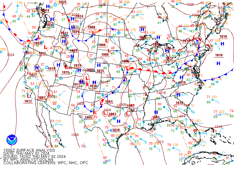
Fig 3. Weather Prediction Center surface analysis for 1500Z June 23rd.
Let's start by looking at surface analysis. We can see that there is a stationary front located just to our southeast this afternoon with some areas of low pressure in eastern Minnesota and western Wisconsin (note this is likely overdone in terms of the number of lows but there is an area of lower pressure in this region as indicated by the wind field). There is also a warm front that extends across South Dakota into the Rocky Mountains associated with a low pressure over Utah. This frontal system will be the culprit for our widespread thunderstorm chances this weekend.
Fig 4. HRRR mesoscale model run initiated at 17Z (12PM CST) through Friday evening. Loop courtesy of tropicaltidbits.comFor today(Friday): The proximity to the stationary front, warm front and low pressure to our south and east will provide some forcing as we go throughout the day. The NWS Twin Cities does not expect this activity to be widespread and notes relatively little wind shear which means storms will be very slow moving if they move at all. What is interesting though is that all the mesoscale models show what seems to be the warm front passing through central Minnesota this evening and being a focus point for widespread showers and thunderstorms moving southwest to northeast. Both ideas make sense but obviously they vary significantly, one thought means widespread rain chances, the other says hardly any rain chance at all. I am going to take a bold and risky move here and say that I don't trust how close the warm front is to our area, as well as that any shift north in that warm front and associated forcing could lead to widespread thunderstorm activity. Therefore I have opted to keep our thunderstorm chances today around 50% due to the uncertainty. I don't want to promise widespread rain but I don't want to dismiss it either. I think our southwestern and western counties have the best chance for thunderstorm development overall but it will be subject to what the warm front does. Therefore is will be important to watch the radar today for the latest developments.
In terms of conditions, any storms that do fire will have a decent amount of moisture to work with as alluded to earlier when I mentioned dew points in the mid to upper 60s. The warm front and stationary front will provide forcing but the shear remains low, so storms will likely be very slow moving. This means that some areas that do see storms could pick up quite a bit of very beneficial rain.
Heading into tonight, the NWS Twin Cities keeps thunderstorm chances around and likely. Looking at mesoscale models, however, there once again seems to be some differences in thinking. Mesoscale models show the warm front passing through central Minnesota this afternoon into the evening hours being the focus for those thunderstorms. The NWS seems to be thinking more along the lines of drier today but more storms tonight. Mesoscale models show hardly any precipitation in the area tonight as the warm front lifts north. Given this, here are the possibilities. Either the warm front passes through earlier like the models indicate as we remain dry overnight or the NWS thought process holds and we still have storms in the area. When there are uncertainties like this I tend to compromise by meeting in the middle so decided to keep storm chances in the forecast. If going out tonight on the town or just hanging out outside, keep an eye on the radar just to be safe.
Given the lack of shear today and tonight, I am not expecting any severe weather. This is because shear helps tilt the updraft and downdraft so that once the storm gets going the falling rain doesn't lead the downdraft to choke the updraft. Without shear, once a storm gets going, the downdraft usually chokes off the updraft and we see dissipation of said thunderstorm within 45 minutes to an hour after initiation. Therefore, the potential for any storms to be severe and long lived it quite low.
Now, for Saturday: This is where things get really tricky! An area of low pressure and the associated cold front are expected to approach from the west and remain in phase with a negatively tilted shortwave trough. This will help to deepen the low as it approaches and thus lead to enhanced vorticity aloft and therefore surface convergence. Given this, showers and thunderstorms will be likely tomorrow throughout the day.
Fig 5. NAM-12km Surface Reflectivity forecast for Friday Night into Saturday. Note the large thunderstorm complex developing across South Dakota moving into Iowa and Minnesota Saturday morning. Loop courtesy of tropicaltidbits.comMesoscale models show a potent Mesoscale Convective System (MCS) moving through South Dakota into Iowa late tonight into tomorrow morning with more stratiform synoptic precipitation taking place across western and northern Minnesota with central Minnesota sorta being left out of any precipitation chances...per usual :( However, I am not sold on this completely and expect that some precipitation will likely make its way through central Minnesota tomorrow morning. Again, not expecting any severe weather with this round of showers or storms.
As we head into the afternoon, positive vorticity advection aloft as well as surface convergence increases as the low pressure approaches from the west. The associated forcing, along with ample moisture and instability will likely lead to widespread thunderstorm development across central Minnesota tomorrow afternoon and lasting through the evening and possibly into the overnight hours. This looks like everyone's best chance of rain and storms. It also looks like central Minnesota's best chance for seeing severe weather since the beginning of May as well.
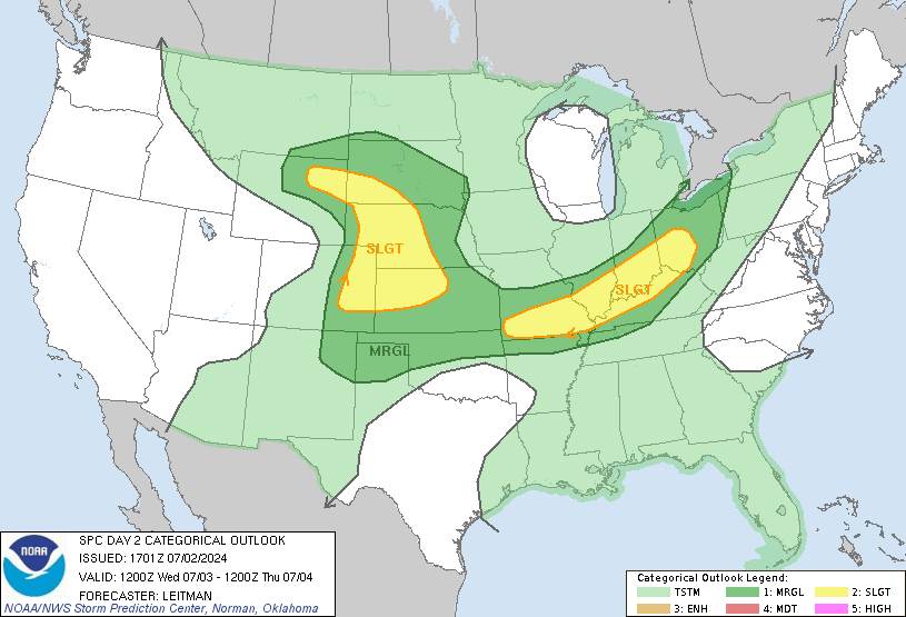
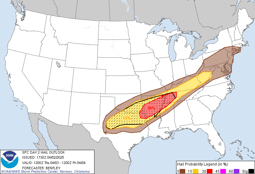
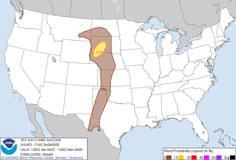
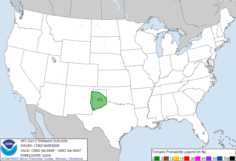
Fig 6. Storm Prediction Center Outlook for Saturday June 24th 2023.
Given proximity to the low pressure, there will likely be an increase in the amount of speed and directional shear across central Minnesota, also alluded to by the models. This, along with instability and moisture will lead to enhanced lift and longer lasting thunderstorm potential. Lapse rate are a bit of a question though as models show a more moist adiabatic lapse profile which is not ideal for severe weather, but forcing and moisture should be enough to lead to some isolated severe storm activity across the area. Large hail and damaging winds are going to be the main threat given that shear is not looking to favorable for any rotating supercells to develop. If anything, this activity will likely be more linear in nature thus the damaging wind chance. These chances are relatively low though as we are only in a marginal risk across much of central Minnesota, and most areas will likely not even see severe weather but it will be something to watch going into tomorrow afternoon and evening.
The main takeaway from tomorrow is that PWAT values are expected to be quite high, so expect some very heavy rain from thunderstorms that do develop and widespread thunderstorm development given the amount of moisture that will be present in the atmosphere as this low pressure works its way in.
Heading into Sunday, the low pressure will pass through the area and exit to our southeast. Lift associated with the low will stick around most of the day on Sunday so showers and some embedded thunderstorms will once again be likely. Some models kick the forcing from the low out sooner than others but if I had to say right now I'd make a bet rain will be around a decent chunk of Sunday and possibly into Sunday night but watch for the details to change as we head into tomorrow and tomorrow night. It will all depend on the speed of the low.
Fig 8. RGEM 1-hr Precipitation rates, MSLP and 1000-500 mb Thickness. Loop courtesy of tropicaltidbits.comHeading into early next week, some weak forcing may still be present on Monday so there is a slight chance of showers but dry air will be mixing in from the NW by this time so sunshine is expected and any showers that do form will by no means be widespread. Calm weather settles back in by Monday night and Tuesday with a more active but seasonable pattern expected to return by the middle to end of next week.
Below is the general forecast for central Minnesota for the next 48-hrs.


Comments
Post a Comment